Eurographics 2024 Full Paper by Zebin Chen, Peng Song, and F. Peter Ortner
We present a computational framework for modeling land parcels and streets. In the real world, parcels and streets are highly coupled with each other since a street network connects all the parcels in a certain area. However, existing works model parcels and streets separately to simplify the problem, resulting in urban layouts with irregular parcels and/or suboptimal streets. In this paper, we propose a hierarchical approach to co-generate parcels and streets from a user-specified polygonal land shape, guided by a set of fundamental urban design requirements. At each hierarchical level, new parcels are generated based on binary splitting of existing parcels, and new streets are subsequently generated by leveraging efficient graph search tools to ensure that each new parcel has a street access. At the end, we optimize the geometry of the generated parcels and streets to further improve their geometric quality. Our computational framework outputs an urban layout with a desired number of regular parcels that are reachable via a connected street network, for which users are allowed to control the modeling process both locally and globally. Quantitative comparisons with state-of-the-art approaches show that our framework is able to generate parcels and streets that are superior in some aspects.
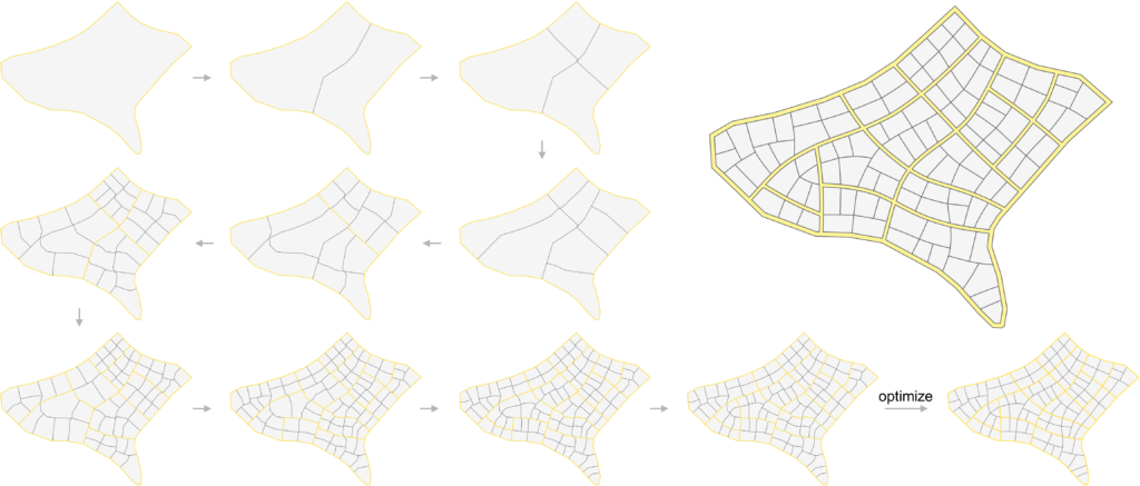
Figure 1: Taking (top left) a polygonal land shape as an input, our approach hierarchically co-generates parcels (in grey) and streets (in yellow) guided by a set of urban design requirements. We perform a (bottom right) global optimization on the co-generated parcels and streets to improve their geometric quality.
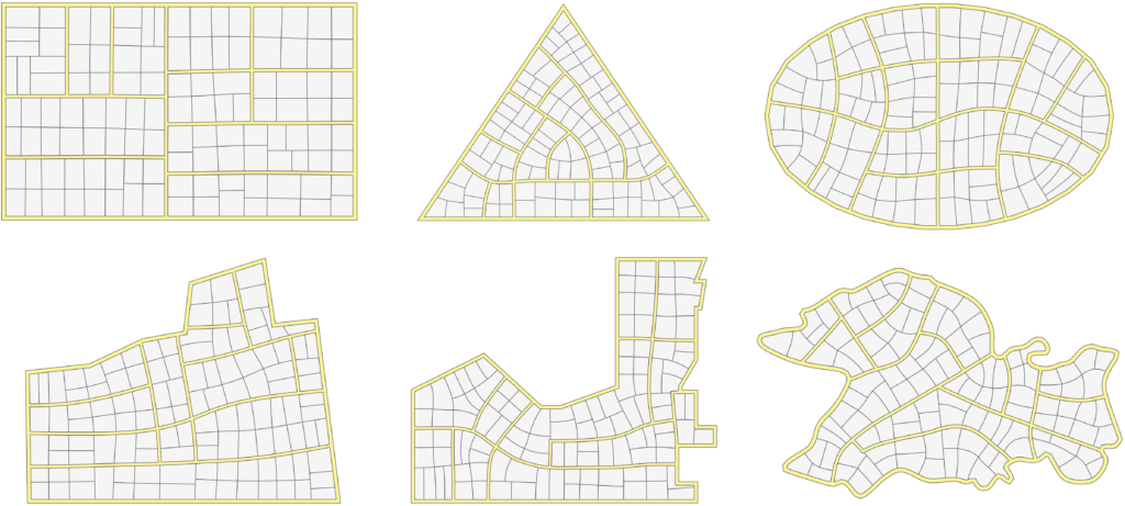
Figure 2: Our framework allows modeling parcels and streets for input lands with (top) regular and (bottom) irregular shapes. (First row from left to right): Rect, Triangle, Ellipse; (Second row from left to right): Wyoming, Sant Adria, Wandsworth.
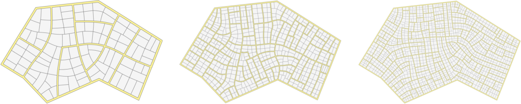
Figure 3: Our framework allows modeling urban layouts for the same input land with different numbers of parcels, i.e., 102, 539, and 1273 parcels.
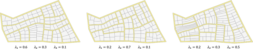
Figure 4: Our framework allows controlling parcel shapes by adjusting the three weights in the streamline quality metric; e.g., the middle layout has more regular parcels, and the right layout has some elongated parcels for sharing the same street access.
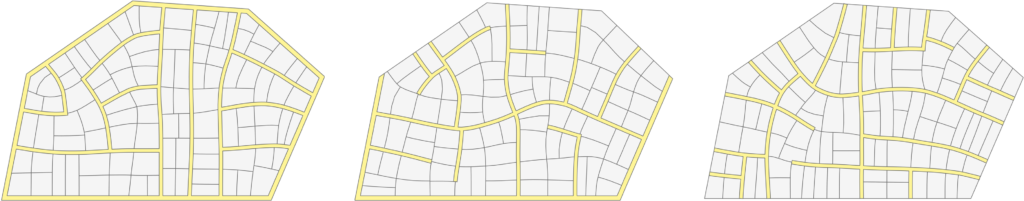
Figure 5: Our framework allows modeling urban layouts for the same input land with different street patterns, from left to right, loop, cul-de-sac, and tree-like patterns. Note that only part of the land boundary is street in the middle layout and none of the land boundary is street in the right layout.
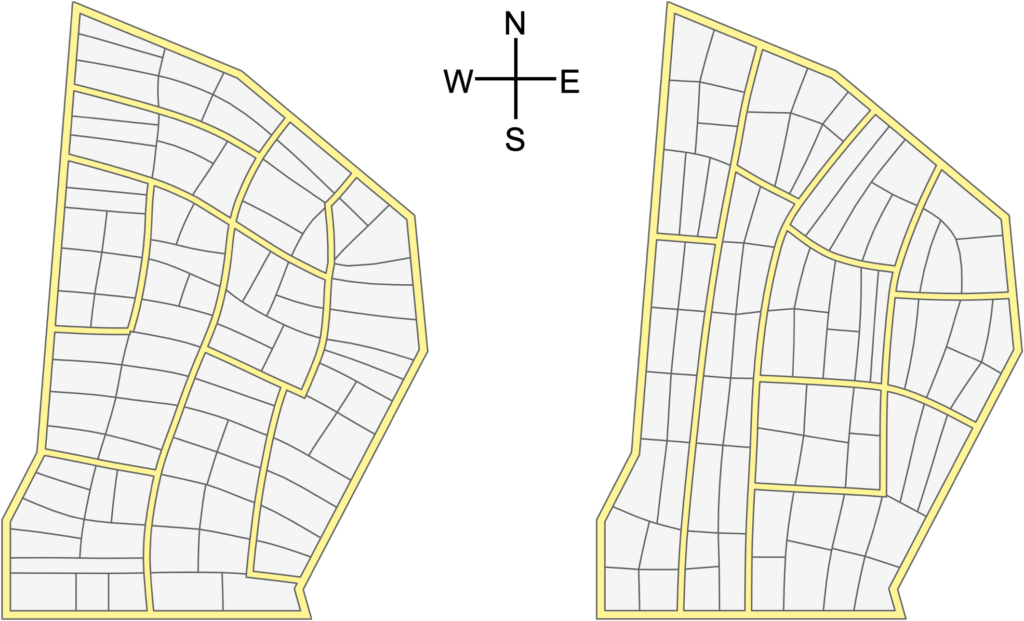
Figure 6: Our framework allows modeling parcels with two different orientations: (left) east-west orientation and (right) north-south orientation.
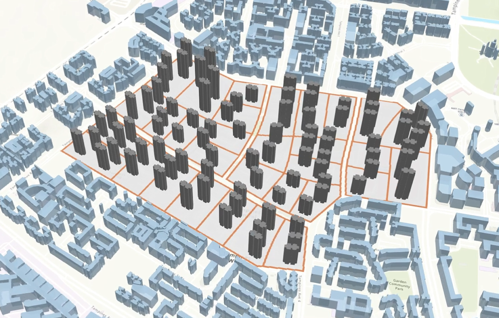
Figure 7: Integrating our co-generation approach into an urban planning tool to generate an urban layout on a city map consisting of not only streets and parcels but also 3D buildings.
Credits:
PI: F Peter Ortner / Co-PI : Peng Song
Research Assistant: Zebin Chen
Funding: URA Strategic Partnership Grant
Acknowledgement: We thank Anna Claudia Yenardi for helping to preview our result within an interactive urban planning tool.